PNE Online
Welcome to PNE-Online. Why not register a free account today to become a member! Once signed in, you'll be able to participate on this site by adding your own topics and posts, as well as connect with other members through your own private inbox! You can also join up as a forum Patron to help support in the running costs of the forum.

The Park Hotel. Miller Park.

europne

0
Patron
Joined
May 5, 2009
Messages
10,440
Ever since going on Miller Park as a kid I have been fascinated by that large building. I understand there is talk of it becoming a hotel again.
Over the years I have picked up the odd bit of memorabilia from it, but not much comes up apart from thousands of postcards.
Has anyone got ant interesting old stuff associated with the hotel, or any interesting stories about it.
 
The highest point was built / adapted during ww2 as a lookout to check for jerry planes and to see the poor state of liverpool.
There was / is still remnants of a private access tunnel from the hotel to the station but its mostly gone. Queen Victoria stayed there many times. The pontoon bridge leading to it is fooked and needs replacing prior to renovation and demolition of adjoining shite monstrosity
 
Funny this has cropped up and Beagleman has mentioned that monstrosity next to this.

I was having a walk from the Capital Centre to the Conti with the Mrs on Saturday and we were mentioning what a beautiful building this is and its setting overlooking the park- hoping it is indeed brought back into some use. A wonderful building!

That grey bag of shit next to it however needs knocking down asap. You would get a headache if you looked at it for too long. Really makes you wonder what dimwits designed it and then what other dimwits gave it permission to be built in that location.
 
Ever since going on Miller Park as a kid I have been fascinated by that large building. I understand there is talk of it becoming a hotel again.
Over the years I have picked up the odd bit of memorabilia from it, but not much comes up apart from thousands of postcards.
Has anyone got ant interesting old stuff associated with the hotel, or any interesting stories about it.

From wiki:
"The Park Hotel was a railway-owned hotel at East Cliff, Preston, Lancashire, England, now used as offices.
The hotel opened in 1883 and was operated jointly by the Lancashire and Yorkshire Railway and London and North Western Railway. In the 1923 grouping of railway companies, ownership passed to the London, Midland and Scottish Railway. When the UK's railways were nationalised in 1948, it passed to the British Transport Commission's Hotels Executive, and thence to British Transport Hotels, who sold it in 1950. It has subsequently been, and as of September 2014 remains, used as offices, and renamed "East Cliff County Offices", by Lancashire County Council, who also have a modern annexe, adjacent.
Located on a small hill, the red-brick building overlooks Preston railway station, on the West Coast Main Line, to its north-west and Miller Park and the River Ribble to its south-east. In its heyday, the hotel was connected to the southern end of the main south-bound platform (the modern-day platform 4) at Preston station by a covered footbridge.
Various pre-1923 objects from the hotel are in the National Railway Museum at York. These include Mappin & Webb cutlery and Elkington & Co. tableware and candlesticks, the latter marked with the initials "P.P." and a lamb and flag, the coat of arms of the city."


My dad told me that most of the Division 1 teams based in the south and midlands, playing at Deepdale on Saturday afternoons during the 1930's, stayed overnight at the hotel on Fridays.
 
Ever since going on Miller Park as a kid I have been fascinated by that large building. I understand there is talk of it becoming a hotel again.
Over the years I have picked up the odd bit of memorabilia from it, but not much comes up apart from thousands of postcards.
Has anyone got ant interesting old stuff associated with the hotel, or any interesting stories about it.


Link to old thread 2005

 
Close to UCLAN, so this doesn't surprise me, the uni will create a fair bit of demand actually.

Yeah, fair point, visiting parents, conferences, guest speakers etc.

Suppose you under-estimate the amount of people involved with a university.
 
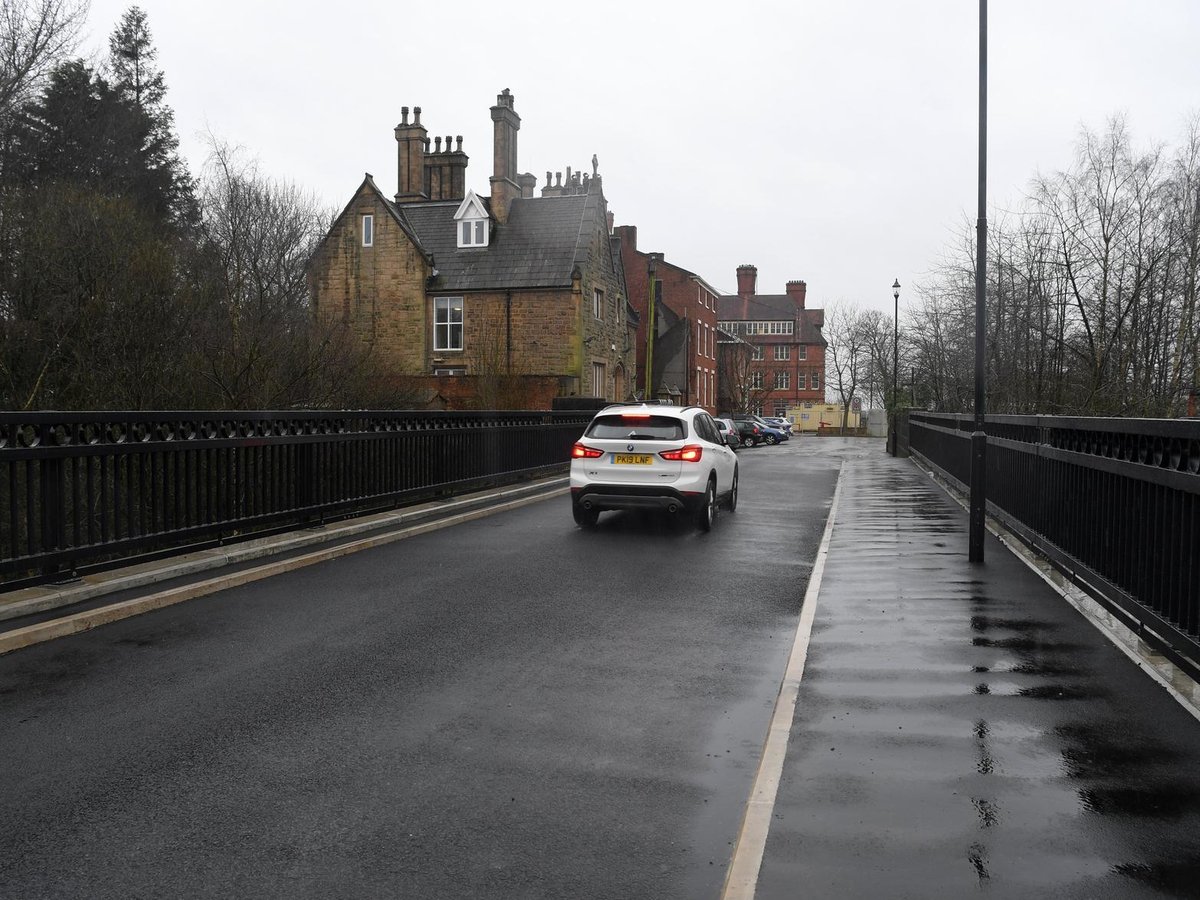
The bridge leading to it is having the foundations done by the look of it today, scaffolding up etc so somethings going on
 
The bridge leading to it is having the foundations done by the look of it today, scaffolding up etc so somethings going on

Looks like it’s done now.

What’s the current situation with the Park Hotel development?? Anyone in the know?
 
Read something the other day, but can’t find it now, that the bridge works were complete and the bridge was open.

Heard nothing about the hotel. Hope it fares better than the old post office, which appears to have stalled.

Found the link about the bridge

 
Last edited:
Mark, the bridge replaces the old pontoon one which went from basically Winckley Square to the old park hotel / abandoned council offices. The hotels being renovated and the grey 60s monstrosity next door being demolished. Before this can be done the bridge needed replacing to take the weight of dumper trucks etc moving rubble. So.. Bridge done.. Hotel renovation resumes. Directly under the bridge is fenced off onto Fishergate car park, this used to be the line from Walton Park area into the sidings on Butler st before it was a car park. The tracks gone but the footprint of the lines are still there. Check google earth maps. The hotel used to ( still has?) direct tunnels to the station for vip guests.. Queen Victoria included. Massive history that place.
 
Mark, the bridge replaces the old pontoon one which went from basically Winckley Square to the old park hotel / abandoned council offices. The hotels being renovated and the grey 60s monstrosity next door being demolished. Before this can be done the bridge needed replacing to take the weight of dumper trucks etc moving rubble. So.. Bridge done.. Hotel renovation resumes. Directly under the bridge is fenced off onto Fishergate car park, this used to be the line from Walton Park area into the sidings on Butler st before it was a car park. The tracks gone but the footprint of the lines are still there. Check google earth maps. The hotel used to ( still has?) direct tunnels to the station for vip guests.. Queen Victoria included. Massive history that place.

Interesting; I know there was a tramway that went from the Lancaster Canal branch at Walton Summit, over the old tram bridge, to join the canal at Preston (it would have cost too much to build an aqueduct over the Ribble), somewhere close to what is now the Corporation Street entrance to Fishergate Centre Car Park. I assume that ran close to the area you mention as well.
 
Interesting; I know there was a tramway that went from the Lancaster Canal branch at Walton Summit, over the old tram bridge, to join the canal at Preston (it would have cost too much to build an aqueduct over the Ribble), somewhere close to what is now the Corporation Street entrance to Fishergate Centre Car Park. I assume that ran close to the area you mention as well.


You certainly right, as per the map below.

1849 Map of Preston

Firstly with regards to what went under that bridge to the hotel we are on about here, you will see there was indeed train lines that linked up-to the station.

Also however as @Schemer mentioned, the canal used to terminate literally at the back of the Corn Exchange in an area known as 'Coal Wharfe'. So basically right in front of where the Premier Inn is now, that ring-road junction, would have been a canal.

Then as for the tramway, you'll also see that does indeed run from this canal terminal, under Fishergate (I believe this may be the tunnel that is now used for the Fishergate car park, may be wrong however), around the top of Avenham and through onto the old tram bridge (now closed of course) that lead up to Walton Summit.

The other end at Walton Summit can also be found in this map:

1848 Map

I'm a bit of a nerd when it comes to History & old maps, etc. :sneaky:

No Deepdale stadium on that 1849 Map of Preston either obviously - was all still farmland
I have the two maps covering those areas from 1913. The canal and basin are there but so is Deepdale next to Sherburne House and Deepdale Brick and Tile works
 
Top